100% CoreIsle Proprietary Engine · Powers CariRoam
3D Island View, ground-level Street View & AI routing.
Core Isle Solutions deploys our pre-existing, 100% owned 3D Geospatial, Transit Telemetry & AI Routing Engine (licensed to power the CariRoam platform) and fail-closed clinical architectures to build ambitious custom platforms across the Caribbean.
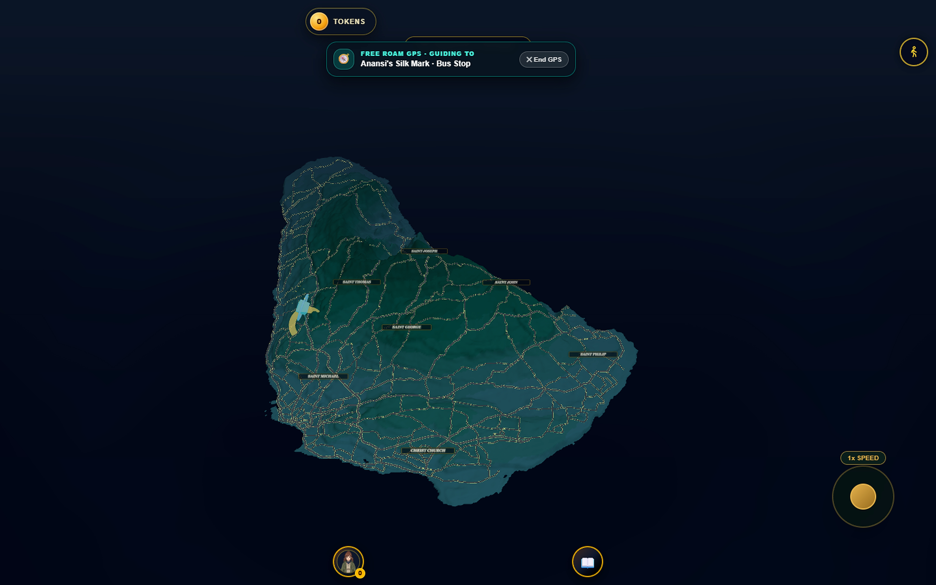
3D Island View: Live 3D WebGL Barbados terrain, 11 parish boundaries, full road network, and active GPS route guidance.
Owned infrastructure we customize for your industry.
3D Island & Street-View WebGL
Copernicus terrain, road corridors & 3D vehicles
Zero-download 60 FPS 3D island maps and ground-level street arenas with GPS hysteresis, bus-stop totems, and custom 3D fleet rendering for tourism, resorts, and real estate.
AI Routing & Live Telemetry
Multi-modal transit solver & crowd GPS probes
Multi-modal routing across bus, ZR van, and walking legs paired with Anansi AI itinerary curation, QR merchant voucher scanners, and k-anonymous live telemetry dashboards.
Fail-Closed Clinical & Enterprise Security
Audited RLS databases, SBAR & TOTP MFA
Every custom platform is hardened with PostgreSQL Row-Level Security, Zod boundary validation, immutable audit logs, and automated test gates.
Vitals Clinical Protocol: bedside SBAR handovers & audited triage.
Watch the Vitals clinical walkthrough — featuring structured bedside SBAR shift handovers, urgent NEWS2 escalation logs, and strict role-scoped PostgreSQL Row-Level Security.
Video Walkthrough: Structured bedside SBAR handovers, urgent triage escalation logs, and fail-closed PostgreSQL ward isolation.
Engineered for 60 FPS WebGL fluidity and fail-closed security.
60 FPS WebGL Lifecycle
Zero-allocation render loops & GPU cleanup
3D island terrain meshes, ZR bus geometries, and corridor markers dispose geometries and textures cleanly with mobile-first draw-call budgets.
Privacy-First Telemetry
k-Anonymous crowd probes & GPS hysteresis
Transit telemetry aggregates anonymous corridor probes with 30m/45m hysteresis stabilization so transient urban GPS jitter never causes false mode switches.
Clinical Fail-Closed RLS
Audited SBAR handovers & role isolation
High-assurance modules such as Vitals Clinical default-deny every unauthenticated or cross-ward query at the PostgreSQL policy layer.
3D spatial licensing, telemetry & clinical architecture answers.
Do users need to download a native app to view the 3D Island or Street maps?
No. Everything runs natively in mobile and desktop browsers via WebGL with progressive loading for slow cellular connections.
Who owns the 3D Spatial & AI Routing infrastructure?
Core Isle Solutions retains 100% ownership of the spatial, telemetry, and routing engine (licensed to power the CariRoam platform) and licenses custom builds for tourism boards, resorts, logistics, and real estate.
Can you adapt this architecture for private real-estate twins or logistics fleets?
Yes. We replace transit layers with resort villa amenities, agricultural plots, utility assets, or delivery truck corridors wired to live GPS feeds.
How are high-assurance medical systems like Vitals secured?
Through fail-closed PostgreSQL Row-Level Security, strict Zod validation, immutable SBAR sign-off hashes, and optional TOTP multi-factor authentication.
Have an ambitious system to build?
Multi-Vendor, 3D Spatial & Enterprise Systems start from $12,000+ BBD (beginning with a $350 architecture blueprint credited 100% toward your build) and are billed in concrete 40/30/30 milestones.